CHIKHWAWA DISTRICT HAZARD MAP, 1/180 000e
Library
Communication material
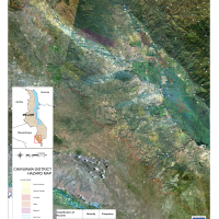
COOPI- Christian Aid/Malawi/2011. CHIKHWAWA DISTRICT HAZARD MAP, Malawi. 1/180 000e; This Map was produced by Coopi, working with the Department of Geoinformatics, University of Salzburg, Austria, and the United Nations office for Outer Space Affairs, in the framework of COOPI's Project " Providing Geographical Information Systems (GIS) technical support for Disaster Risk Reduction programmes implemented by DIPECHO partners in the South East African and South West Indian Ocean region" ECHO/DIP/BUD/2010/04004
33
Views
93
Downloads
0
0
Comments
Document details
Created:
Image
Log in with your EU Login account to post or comment on the platform.